
Wayonara
Kjeragbolten

Kjeragbolten

Sandnes Municipality · Rogaland · Norway

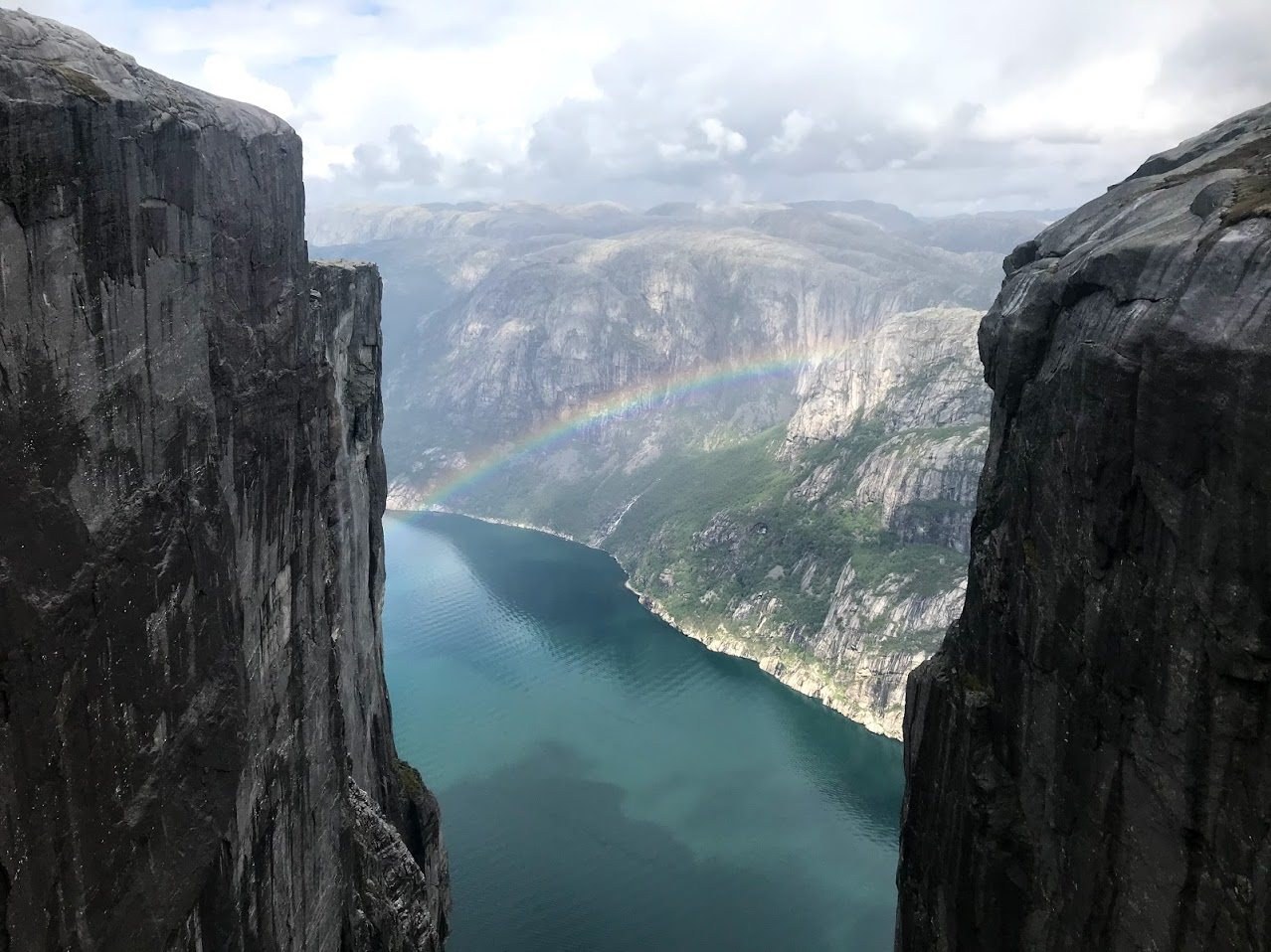
Kjeragbolten in Norway’s Rogaland region draws mountain travelers for its alpine trails and iconic boulder wedged in a cliffside.

@wildheightsWild Heights
Scanned 13/09/2026
Location found

Kjeragbolten

Place, map and geographic details identified in this scan.

Place
Kjeragbolten
City
Sandnes Municipality
Region
Rogaland
Country
Norway
Coordinates
59.03467, 6.57752
Download app iOS

Save the place, add dates and compare real routes in Wayonara.

Kjeragbolten’s Cliffside Sweep

Kjeragbolten stands out for its distinctive cliffside boulder suspended over a deep valley, an anchor point for hikers seeking alpine challenge and striking views. The surrounding trails offer an engagement with Rogaland’s high mountain terrain, rewarding travelers drawn to nature’s quiet extremes with both effort and perspective. For those oriented to mountain travel, Kjeragbolten provides more than a landmark; it epitomizes the tension and scale found in Norway’s rugged landscape. Its established trail network presents a meaningful route through alpine rock and highland scenery, inviting contemplation of terrain that sits resolutely above the clouds.

Transport & route

Share location once or enter a departure city. Your position is rounded and never published.

Costs

Prices shown here are either recently checked or clearly marked as indicative.

Hotels fromindicative estimate from €125/night

Your plan

A balanced plan by day, with realistic timing, food stops and bookable experiences.

3-day planProvider-backed
Kjeragfossen waterfall
Day 1

Kjeragfossen waterfall

  1. 09:30–11:00
    Attraction

    Kjeragfossen waterfall

    Selected from real place data and sequenced to keep the route compact.

    90 min4.7Provider-backed
  2. 13:00–14:00
    Lunch

    Kjerag Cafe & Restaurant (Øygardstøl)

    A nearby food stop selected to fit naturally into the route.

    60 min~20 min transfer4.2Provider-backed
Day 2

Kjeragfoss

  1. 09:30–11:00
    Attraction

    Kjeragfoss

    Selected from real place data and sequenced to keep the route compact.

    90 min3.7Provider-backed
  2. 19:30–20:30
    Dinner

    Flørli Cafe

    A nearby food stop selected to fit naturally into the route.

    60 min~35 min transfer4.7Provider-backed
Day 3

Nesatind

  1. 09:30–11:00
    Attraction

    Nesatind

    Selected from real place data and sequenced to keep the route compact.

    90 min5.0Provider-backed

Times are suggested. Check opening hours and availability before you go.

Nearby places

Weather & climate

Partly cloudy7°CFeels 4°C
Now7°CFeels 4°C
Wind12 km/hCurrent speed
Humidity80%Current level
Humidity
80%

Year-round rhythm

Climate rhythm

Monthly highs and lows above; rainfall sits below for quick seasonal reading.
Temp rangeRain
Jan, High -2°C, Low -6°C, Rain 282mmFeb, High -1°C, Low -5°C, Rain 280mmMar, High 1°C, Low -4°C, Rain 176mmApr, High 4°C, Low -2°C, Rain 112mmMay, High 11°C, Low 4°C, Rain 112mmJun, High 14°C, Low 8°C, Rain 179mmJul, High 16°C, Low 10°C, Rain 227mmAug, High 15°C, Low 9°C, Rain 225mmSep, High 13°C, Low 7°C, Rain 196mmOct, High 7°C, Low 3°C, Rain 301mmNov, High 3°C, Low -1°C, Rain 250mmDec, High 0°C, Low -4°C, Rain 303mmJanFebMarAprMayJunJulAugSepOctNovDec

Source: Open-Meteo

What to pack

A compact packing start based on destination conditions.

Comfortable walking shoes

A warm insulating layer

A refillable water bottle

Where to eat

Restaurant · Closed now · 4.5 km

Kjerag Cafe & Restaurant (Øygardstøl)

4.2 (1,143)
Restaurant · 8.8 km

Flørli Cafe

4.7 (54)

Good to know

Currency

NOK (kr)

Languages

Norwegian Nynorsk · Norwegian Bokmål · Sami

Time zone

Europe/Oslo

Plug type

Type C/F

C
F

Power

230V · 50Hz

Public share links only show public scan details. Private scans, origin, budget, saved trip data and account information are not shown here. If the owner deletes this scan or makes it private, this page stops working.

Plan your trip ↗