

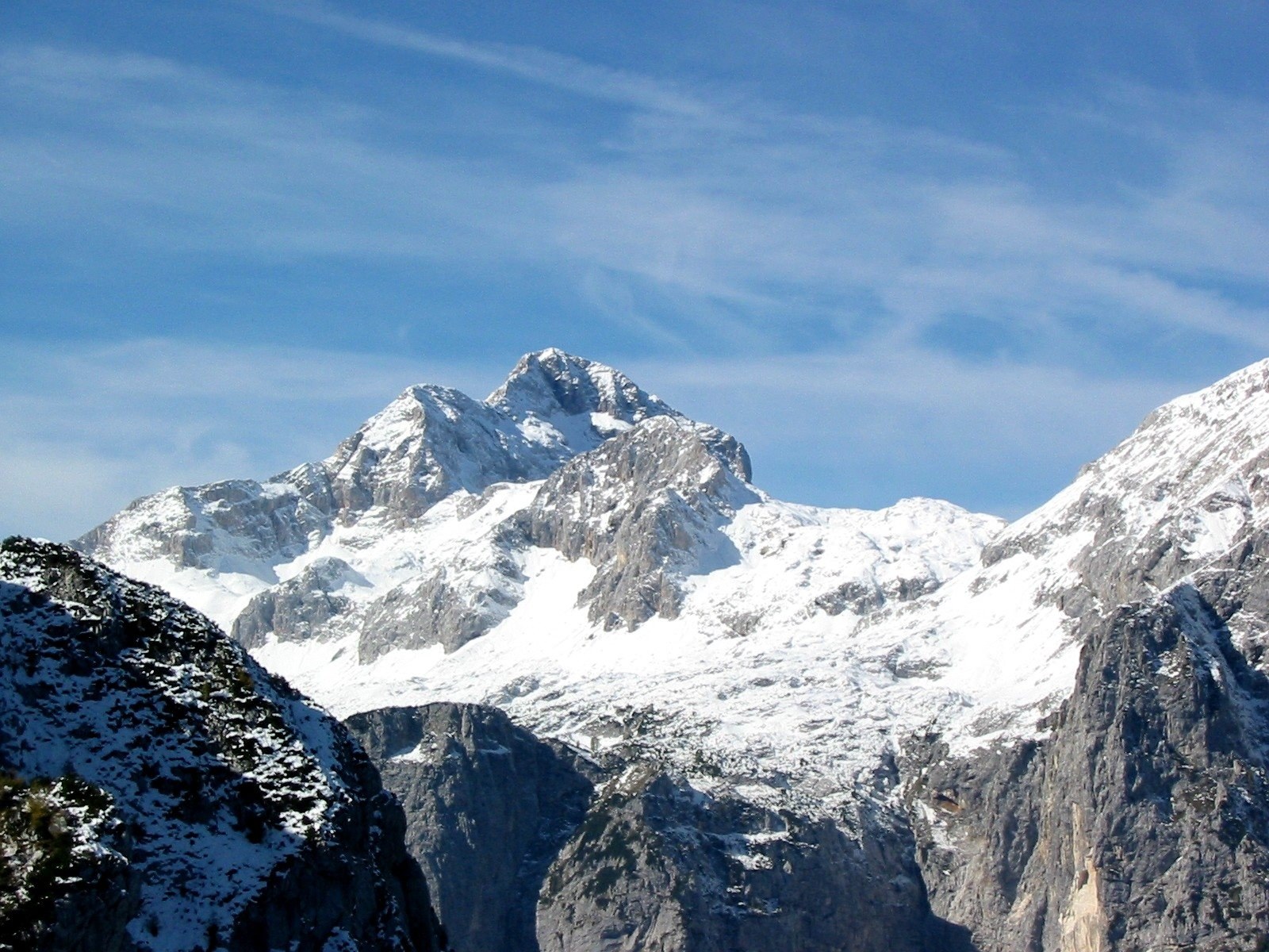
Triglav
Bohinjsko jezero · Radovljica · Slovenia
Triglav in Bohinjsko jezero draws mountain travelers with its high trails and dramatic alpine landscapes within Slovenia’s sole national park.
Triglav in Bohinjsko jezero draws mountain travelers with its high trails and dramatic alpine landscapes within Slovenia’s sole national park.
Place, map and geographic details identified in this scan.
Save the place, add dates and compare real routes in Wayonara.
Mount Triglav, rising above the Bohinjsko jezero area, dominates Slovenia’s Radovljica region and anchors its only national park. Its prominence and surrounding terrain are specifically suited to travelers interested in mountain hiking and alpine nature, offering defined trails that navigate forested slopes and high-altitude rock faces. This setting rewards those seeking mountain travel with a landscape shaped by clear alpine lakes and rugged peaks. The view from Mt. Debela Peč, looking eastward towards Triglav, underscores the photogenic quality of the region—a landscape framed by forest and mountain architecture that reflects the long tradition of alpine life. Such vistas serve as reference points for route planning and nature observation, lending practical as well as contemplative value to an itinerary focused on high-altitude environments.
Share location once or enter a departure city. Your position is rounded and never published.
Prices shown here are either recently checked or clearly marked as indicative.
A balanced plan by day, with realistic timing, food stops and bookable experiences.
Slap Suha
Times are suggested. Check opening hours and availability before you go.
Year-round rhythm
Climate rhythm
Monthly highs and lows above; rainfall sits below for quick seasonal reading.Source: Open-Meteo
A compact packing start based on destination conditions.
EUR (€)
Slovene
Type C/F
230V · 50Hz
Public share links only show public scan details. Private scans, origin, budget, saved trip data and account information are not shown here. If the owner deletes this scan or makes it private, this page stops working.