

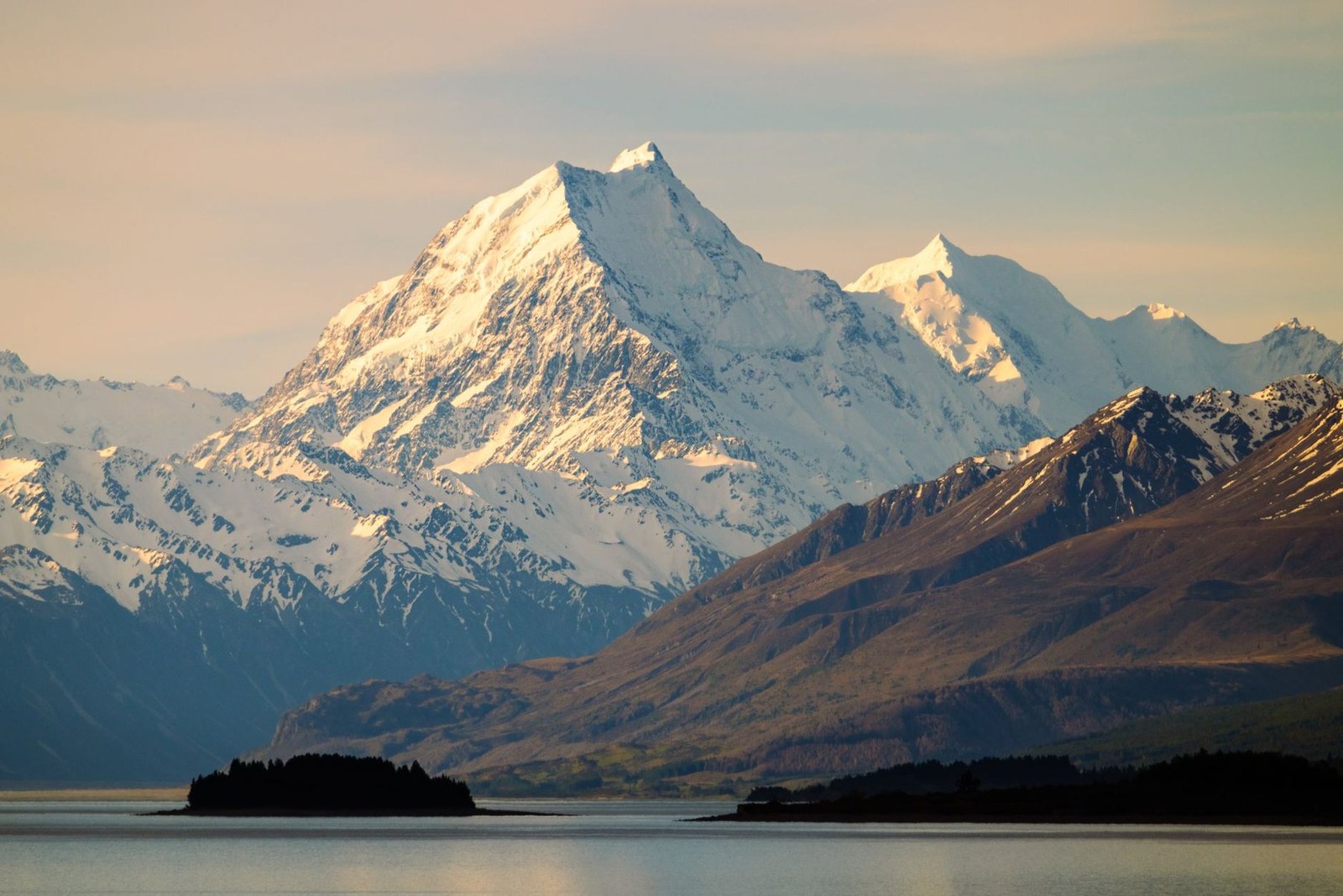
Aoraki / Mount Cook
Aoraki · Canterbury Region · New Zealand
Snow-capped peaks rise above Lake Pukaki, offering a serene setting for hiking and photography.
Snow-capped peaks rise above Lake Pukaki, offering a serene setting for hiking and photography.
ระบุสถานที่ แผนที่ และรายละเอียดทางภูมิศาสตร์จากการสแกนนี้แล้ว
บันทึกสถานที่ เพิ่มวันที่ and เปรียบเทียบเส้นทางจริงใน Wayonara
Aoraki / Mount Cook stands as the highest peak in New Zealand’s Canterbury Region, its alpine profile etched against dramatic skies. The park’s well-marked trails invite measured hiking, with vantage points tailored for contemplative nature watching and refined landscape photography. Lake Pukaki’s calm waters reflect the mountain’s changing light through the day, best noted during sunset hours. Beyond the summit views, the setting encourages a slow rhythm—walking among native flora, breathing crisp air and absorbing the stillness that defines this national park. Activities here privilege stamina and mindfulness over speed, ideal for travellers seeking an active connection with the Southern Alps’ alpine environment.
แชร์ตำแหน่งหนึ่งครั้งหรือระบุเมืองที่ออกเดินทาง ตำแหน่งของคุณจะถูกปัดเศษและจะไม่ถูกเผยแพร่
ราคาที่แสดงที่นี่เป็นราคาที่มีการตรวจสอบล่าสุดหรือระบุไว้ชัดเจนว่าเป็นราคาโดยประมาณ
การเยี่ยมชมที่แนะนำ
Aoraki/Mt Cook
Aoraki/Mt Cook High Peak
เวลาเป็นเพียงการแนะนำ โปรดตรวจสอบเวลาทำการและความพร้อมก่อนเดินทาง
สภาพอากาศตลอดทั้งปี
วัฏจักรภูมิอากาศ
อุณหภูมิสูงสุดและต่ำสุดรายเดือนแสดงอยู่ด้านบน ปริมาณน้ำฝนแสดงอยู่ด้านล่างเพื่อให้ดูข้อมูลตามฤดูกาลได้อย่างรวดเร็วแหล่งที่มา: Open-Meteo
รายการจัดกระเป๋าเบื้องต้นที่เหมาะกับสภาพแวดล้อมของจุดหมายปลายทาง
Use Aoraki / Mount Cook as the destination context and choose verified regional food guides before deciding where or what to eat.
NZD ($)
English · Māori · New Zealand Sign Language
Pacific/Chatham
Type I
230V · 50Hz
ลิงก์แชร์สาธารณะจะแสดงเฉพาะรายละเอียดการสแกนสาธารณะเท่านั้น การสแกนส่วนตัว จุดเริ่มต้น งบประมาณ ข้อมูลทริปที่บันทึกไว้ และข้อมูลบัญชีจะไม่ถูกแสดงที่นี่ หากเจ้าของลบการสแกนนี้หรือตั้งค่าเป็นส่วนตัว หน้านี้จะหยุดทำงาน