

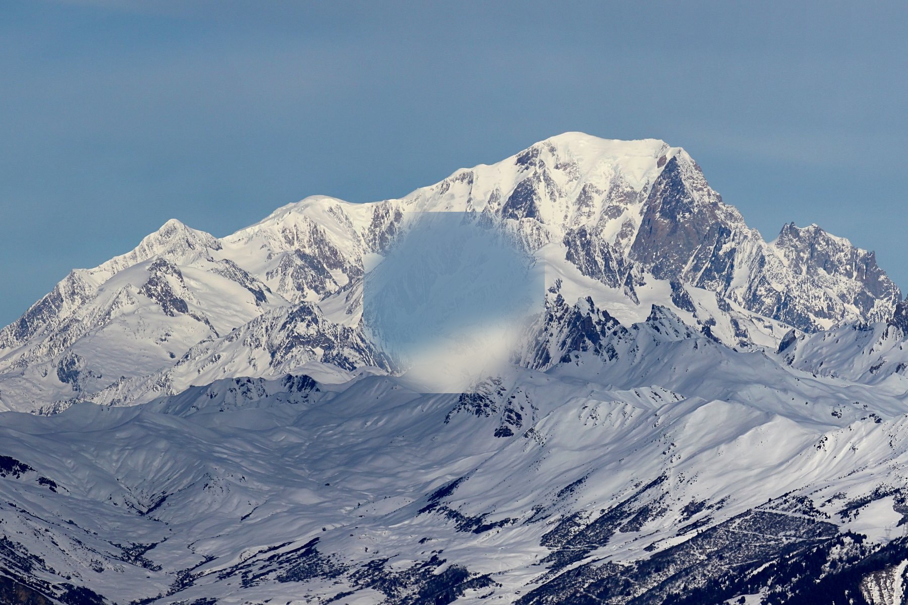
Mont Blanc
Mont Blanc in Auvergne-Rhône-Alpes offers alpine hikers well-defined trails and striking mountain terrain to explore.
Mont Blanc in Auvergne-Rhône-Alpes offers alpine hikers well-defined trails and striking mountain terrain to explore.
ระบุสถานที่ แผนที่ และรายละเอียดทางภูมิศาสตร์จากการสแกนนี้แล้ว
บันทึกสถานที่ เพิ่มวันที่ and เปรียบเทียบเส้นทางจริงใน Wayonara
Mont Blanc, towering above Chamonix in France’s Auvergne-Rhône-Alpes, is a defining presence for travelers drawn to mountain landscapes. Its south face, visible from Valmorel, illustrates the classic alpine environment that anchors a network of high-altitude hiking routes. These trails, framed by glacier-carved valleys and seasonal mountain flora, provide a measured challenge suitable for those seeking immersion in natural alpine settings. For mountain travellers focused on elevation and terrain, Mont Blanc’s range is a locus of both accessible and extended high trails. The surrounding region also includes established huts and traditional alpine architecture, offering waypoints for multi-day itineraries. This blend of geographic prominence and practical mountain infrastructure secures Mont Blanc’s relevance within specialized alpine travel interests.
แชร์ตำแหน่งหนึ่งครั้งหรือระบุเมืองที่ออกเดินทาง ตำแหน่งของคุณจะถูกปัดเศษและจะไม่ถูกเผยแพร่
ลิงก์แชร์สาธารณะจะแสดงเฉพาะรายละเอียดการสแกนสาธารณะเท่านั้น การสแกนส่วนตัว จุดเริ่มต้น งบประมาณ ข้อมูลทริปที่บันทึกไว้ และข้อมูลบัญชีจะไม่ถูกแสดงที่นี่ หากเจ้าของลบการสแกนนี้หรือตั้งค่าเป็นส่วนตัว หน้านี้จะหยุดทำงาน