

Roys Peak
Wānaka · Otago Region · New Zealand
Roys Peak gives mountain travellers a stronger day when route, weather and turnaround margins are decided first.
Roys Peak gives mountain travellers a stronger day when route, weather and turnaround margins are decided first.
ระบุสถานที่ แผนที่ และรายละเอียดทางภูมิศาสตร์จากการสแกนนี้แล้ว
บันทึกสถานที่ เพิ่มวันที่ and เปรียบเทียบเส้นทางจริงใน Wayonara
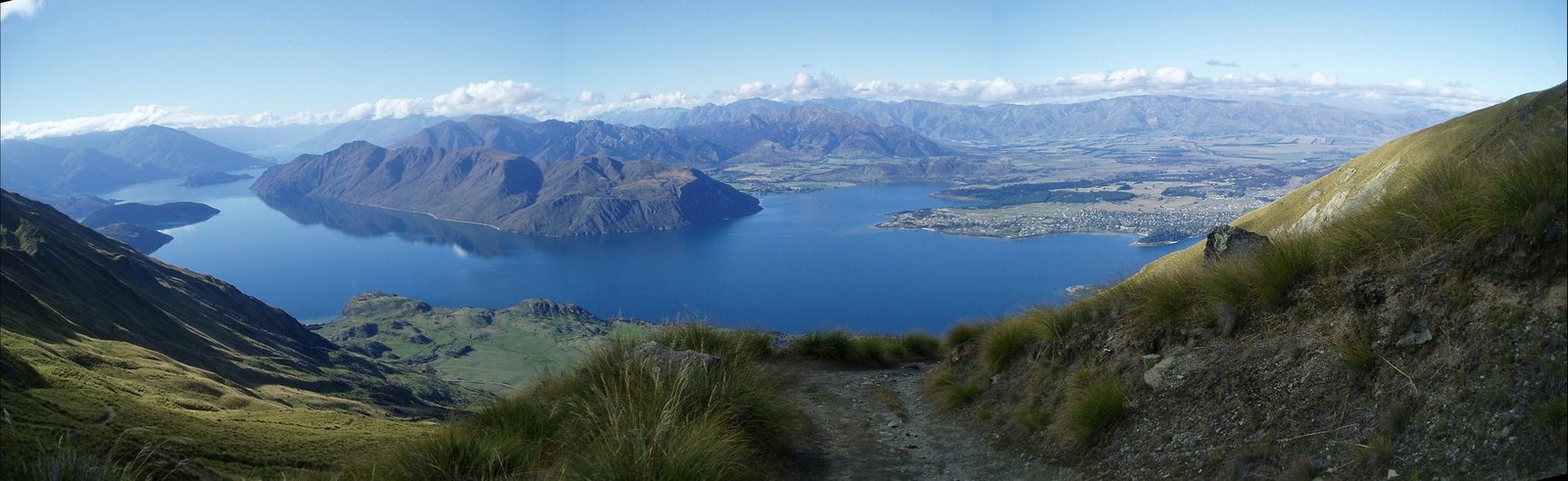
Roys Peak rises above Wānaka with wide views across Lake Wānaka and the Southern Alps. The commonly used route is a sustained uphill effort on an exposed slope rather than a short viewpoint stroll, and the open terrain offers little shelter from sun, wind or rapid weather changes. Treat the ascent and descent as one continuous workload, reserving at least half of the day’s energy for the long return. Set a primary route, a shorter alternative and a firm turnaround point before starting. Compare distance, ascent and surface with the group’s real experience, not only the headline viewpoint. Begin with enough daylight, take measured breaks and keep the return route easy to identify even if cloud reduces visibility. Mountain travellers should treat Roys Peak as an outing whose quality depends on preparation. Match distance and ascent to the least experienced person, keep turnaround time visible, and preserve energy for the return. A clear route plan creates more time to notice terrain, weather and scale without turning the day into a race. Check current track access and any seasonal restrictions before departure; do not rely on an old trip report for availability.
แชร์ตำแหน่งหนึ่งครั้งหรือระบุเมืองที่ออกเดินทาง ตำแหน่งของคุณจะถูกปัดเศษและจะไม่ถูกเผยแพร่
ราคาที่แสดงที่นี่เป็นราคาที่มีการตรวจสอบล่าสุดหรือระบุไว้ชัดเจนว่าเป็นราคาโดยประมาณ
แผนการท่องเที่ยวที่สมดุลแบ่งตามวัน พร้อมเวลาที่เหมาะสม จุดแวะพักรับประทานอาหาร และประสบการณ์ที่จองล่วงหน้าได้
The place itself
Notice Roys Peak and the details that make it recognizable.
เวลาเป็นเพียงการแนะนำ โปรดตรวจสอบเวลาทำการและความพร้อมก่อนเดินทาง
สภาพอากาศตลอดทั้งปี
วัฏจักรภูมิอากาศ
อุณหภูมิสูงสุดและต่ำสุดรายเดือนแสดงอยู่ด้านบน ปริมาณน้ำฝนแสดงอยู่ด้านล่างเพื่อให้ดูข้อมูลตามฤดูกาลได้อย่างรวดเร็วแหล่งที่มา: Open-Meteo
รายการจัดกระเป๋าเบื้องต้นที่เหมาะกับสภาพแวดล้อมของจุดหมายปลายทาง
Use Roys Peak as the destination context and choose verified regional food guides before deciding where or what to eat.
NZD ($)
English · Māori · New Zealand Sign Language
Pacific/Chatham
Type I
230V · 50Hz
ลิงก์แชร์สาธารณะจะแสดงเฉพาะรายละเอียดการสแกนสาธารณะเท่านั้น การสแกนส่วนตัว จุดเริ่มต้น งบประมาณ ข้อมูลทริปที่บันทึกไว้ และข้อมูลบัญชีจะไม่ถูกแสดงที่นี่ หากเจ้าของลบการสแกนนี้หรือตั้งค่าเป็นส่วนตัว หน้านี้จะหยุดทำงาน