

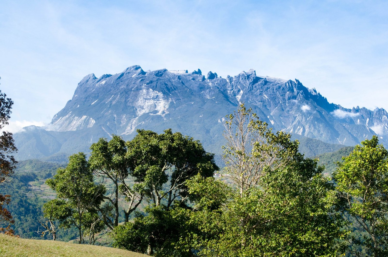
Mount Kinabalu
Ranau · Sabah · Malaysia
Mount Kinabalu gives mountain travellers a stronger day when route, weather and turnaround margins are decided first.
Mount Kinabalu gives mountain travellers a stronger day when route, weather and turnaround margins are decided first.
Sted, kort og geografiske oplysninger identificeret i denne scanning.
Gem stedet, tilføj datoer, og sammenlign faktiske ruter i Wayonara.
Mount Kinabalu rises above Sabah as a high granite massif with distinct vegetation zones from lower forest to exposed summit terrain. A summit itinerary is a managed high-altitude undertaking, not an independent casual hike, and the transition from humid lower slopes to cold upper ground is physically significant. Build the schedule around approved access, required guiding arrangements and gradual pacing; height gain matters more than fast distance. Set a primary route, a shorter alternative and a firm turnaround point before starting. Compare distance, ascent and surface with the group’s real experience, not only the headline viewpoint. Begin with enough daylight, take measured breaks and keep the return route easy to identify even if cloud reduces visibility. Mountain travellers should treat Mount Kinabalu as an outing whose quality depends on preparation. Match distance and ascent to the least experienced person, keep turnaround time visible, and preserve energy for the return. A clear route plan creates more time to notice terrain, weather and scale without turning the day into a race. Confirm current park permits, guide rules, accommodation and summit access before travel, and treat headache, nausea or unusual fatigue as signals to slow or descend.
Del din placering én gang, eller angiv en afrejseby. Din position afrundes og offentliggøres aldrig.
Priserne, der vises her, er enten tjekket for nylig eller tydeligt markeret som vejledende.
Kun scanningsstedet er tilgængeligt. En fuld rejseplan kræver flere bekræftede stop.
Foreslået besøg
Årlig rytme
Klimarytme
Månedlige maksimum- og minimumstemperaturer vises ovenfor; nedbørsmængder vises nedenfor, så du hurtigt kan danne dig et indtryk af sæsonen.Kilde: Open-Meteo
En kompakt pakkeliste baseret på forholdene på destinationen.
Use Mount Kinabalu as the destination context and choose verified regional food guides before deciding where or what to eat.
MYR (RM)
English · Malay
Type G
230/240V · 50Hz
Offentlige delingslinks viser kun detaljer om den offentlige scanning. Private scanninger, udgangspunkt, budget, gemte rejsedata og kontooplysninger vises ikke her. Hvis ejeren sletter scanningen eller gør den privat, vil denne side ikke længere fungere.