

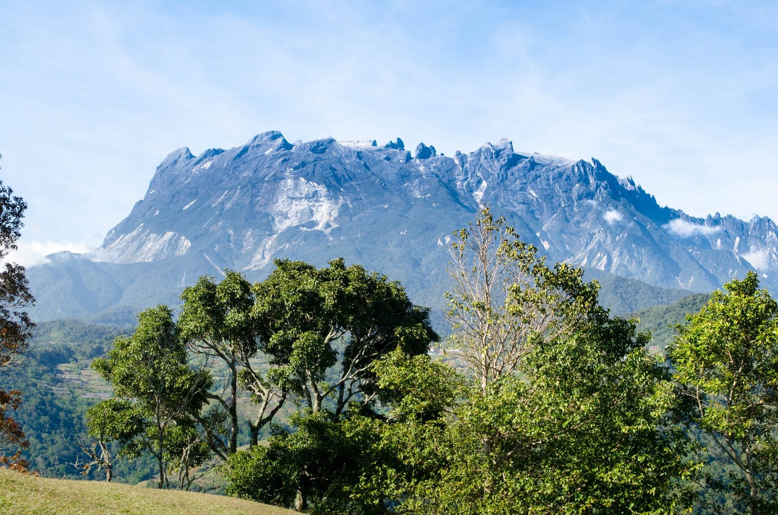
Mount Kinabalu
Ranau · Sabah · Malaysia
Mount Kinabalu gives mountain travellers a stronger day when route, weather and turnaround margins are decided first.
Mount Kinabalu gives mountain travellers a stronger day when route, weather and turnaround margins are decided first.
Miejsce, mapa i szczegóły geograficzne zidentyfikowane w tym skanie.
Zapisz miejsce, dodaj daty i porównaj realne trasy w Wayonara.
Mount Kinabalu rises above Sabah as a high granite massif with distinct vegetation zones from lower forest to exposed summit terrain. A summit itinerary is a managed high-altitude undertaking, not an independent casual hike, and the transition from humid lower slopes to cold upper ground is physically significant. Build the schedule around approved access, required guiding arrangements and gradual pacing; height gain matters more than fast distance. Set a primary route, a shorter alternative and a firm turnaround point before starting. Compare distance, ascent and surface with the group’s real experience, not only the headline viewpoint. Begin with enough daylight, take measured breaks and keep the return route easy to identify even if cloud reduces visibility. Mountain travellers should treat Mount Kinabalu as an outing whose quality depends on preparation. Match distance and ascent to the least experienced person, keep turnaround time visible, and preserve energy for the return. A clear route plan creates more time to notice terrain, weather and scale without turning the day into a race. Confirm current park permits, guide rules, accommodation and summit access before travel, and treat headache, nausea or unusual fatigue as signals to slow or descend.
Udostępnij lokalizację raz lub wpisz miasto wyjazdu. Twoja pozycja jest zaokrąglana i nigdy nie jest publikowana.
Wyświetlane ceny zostały ostatnio sprawdzone lub są wyraźnie oznaczone jako szacunkowe.
Dostępne jest tylko miejsce skanu. Pełny plan wymaga kolejnych potwierdzonych przystanków.
Proponowana wizyta
Rytm całoroczny
Rytm klimatyczny
Miesięczne maksima i minima powyżej; opady deszczu poniżej dla szybkiego odczytu sezonowego.Źródło: Open-Meteo
Kompaktowa lista rzeczy na start w oparciu o warunki w miejscu docelowym.
Use Mount Kinabalu as the destination context and choose verified regional food guides before deciding where or what to eat.
MYR (RM)
English · Malay
Type G
230/240V · 50Hz
Publiczne linki do udostępniania pokazują wyłącznie szczegóły publicznych skanów. Skanów prywatnych, miejsca wylotu/rozpoczęcia, budżetu, zapisanych danych wycieczki oraz informacji o koncie nie widać w tym miejscu. Jeśli właściciel usunie ten skan lub ustawi go jako prywatny, ta strona przestanie działać.