

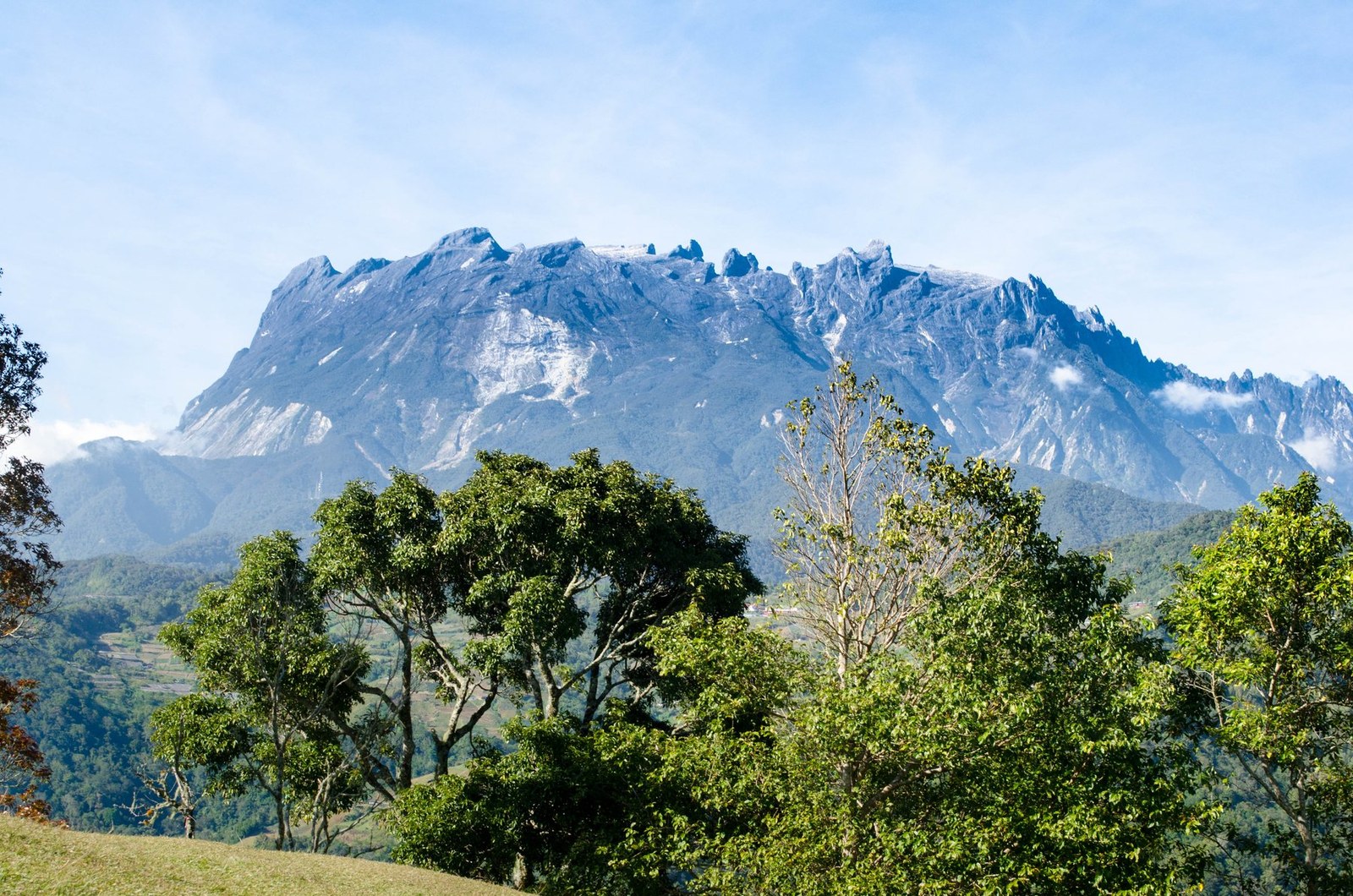
Mount Kinabalu
Ranau · Sabah · Malaysia
Mount Kinabalu gives mountain travellers a stronger day when route, weather and turnaround margins are decided first.
Mount Kinabalu gives mountain travellers a stronger day when route, weather and turnaround margins are decided first.
Lugar, mapa e detalhes geográficos identificados nesta varredura.
Salve o local, adicione datas e compare rotas reais em Wayonara.
Mount Kinabalu rises above Sabah as a high granite massif with distinct vegetation zones from lower forest to exposed summit terrain. A summit itinerary is a managed high-altitude undertaking, not an independent casual hike, and the transition from humid lower slopes to cold upper ground is physically significant. Build the schedule around approved access, required guiding arrangements and gradual pacing; height gain matters more than fast distance. Set a primary route, a shorter alternative and a firm turnaround point before starting. Compare distance, ascent and surface with the group’s real experience, not only the headline viewpoint. Begin with enough daylight, take measured breaks and keep the return route easy to identify even if cloud reduces visibility. Mountain travellers should treat Mount Kinabalu as an outing whose quality depends on preparation. Match distance and ascent to the least experienced person, keep turnaround time visible, and preserve energy for the return. A clear route plan creates more time to notice terrain, weather and scale without turning the day into a race. Confirm current park permits, guide rules, accommodation and summit access before travel, and treat headache, nausea or unusual fatigue as signals to slow or descend.
Compartilhe a localização uma vez ou insira uma cidade de partida. Sua posição é arredondada e nunca publicada.
Os preços exibidos foram verificados recentemente ou estão claramente marcados como indicativos.
Só está disponível o local do scan. Um itinerário completo precisa de mais paradas confirmadas.
Visita sugerida
Ritmo anual
Ritmo climático
Temperaturas máximas e mínimas mensais acima; índice de chuvas abaixo para uma leitura sazonal rápida.Fonte: Open-Meteo
Uma sugestão compacta de bagagem com base nas condições do destino.
Use Mount Kinabalu as the destination context and choose verified regional food guides before deciding where or what to eat.
MYR (RM)
English · Malay
Type G
230/240V · 50Hz
Links de compartilhamento público mostram apenas detalhes de digitalizações públicas. Digitalizações privadas, origem, orçamento, dados de viagens salvas e informações de conta não são exibidos aqui. Se o proprietário excluir esta digitalização ou torná-la privada, esta página deixará de funcionar.