

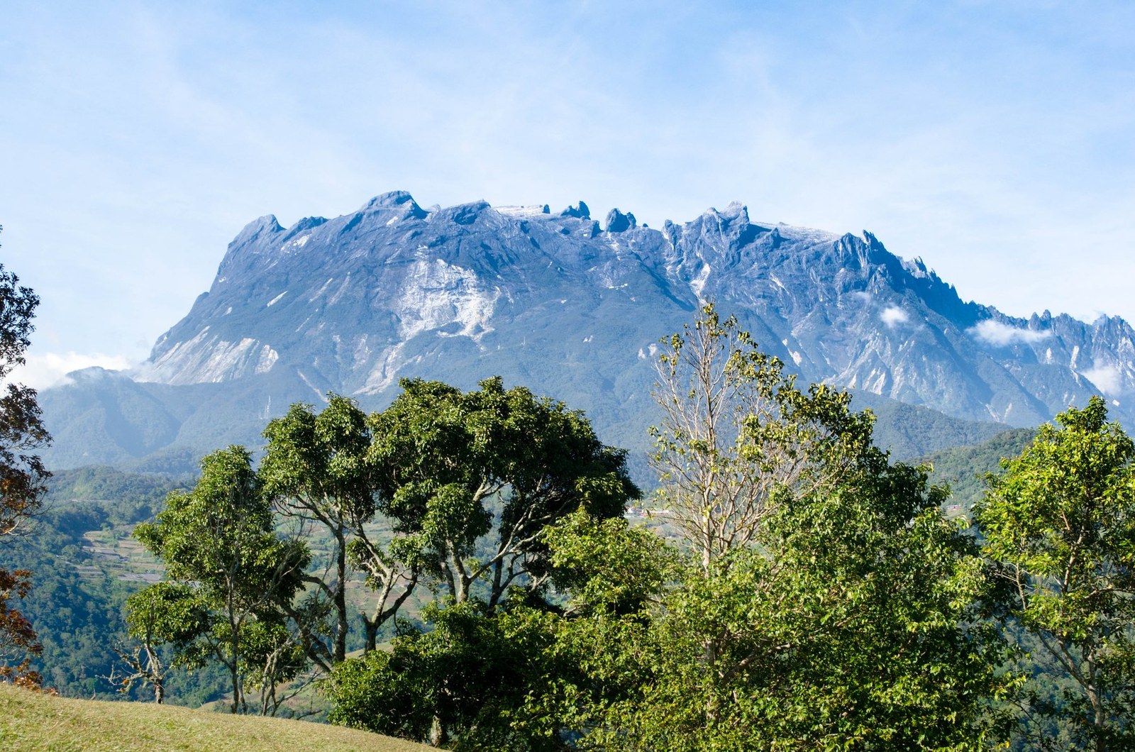
Mount Kinabalu
Ranau · Sabah · Malaysia
Mount Kinabalu gives mountain travellers a stronger day when route, weather and turnaround margins are decided first.
Mount Kinabalu gives mountain travellers a stronger day when route, weather and turnaround margins are decided first.
ระบุสถานที่ แผนที่ และรายละเอียดทางภูมิศาสตร์จากการสแกนนี้แล้ว
บันทึกสถานที่ เพิ่มวันที่ and เปรียบเทียบเส้นทางจริงใน Wayonara
Mount Kinabalu rises above Sabah as a high granite massif with distinct vegetation zones from lower forest to exposed summit terrain. A summit itinerary is a managed high-altitude undertaking, not an independent casual hike, and the transition from humid lower slopes to cold upper ground is physically significant. Build the schedule around approved access, required guiding arrangements and gradual pacing; height gain matters more than fast distance. Set a primary route, a shorter alternative and a firm turnaround point before starting. Compare distance, ascent and surface with the group’s real experience, not only the headline viewpoint. Begin with enough daylight, take measured breaks and keep the return route easy to identify even if cloud reduces visibility. Mountain travellers should treat Mount Kinabalu as an outing whose quality depends on preparation. Match distance and ascent to the least experienced person, keep turnaround time visible, and preserve energy for the return. A clear route plan creates more time to notice terrain, weather and scale without turning the day into a race. Confirm current park permits, guide rules, accommodation and summit access before travel, and treat headache, nausea or unusual fatigue as signals to slow or descend.
แชร์ตำแหน่งหนึ่งครั้งหรือระบุเมืองที่ออกเดินทาง ตำแหน่งของคุณจะถูกปัดเศษและจะไม่ถูกเผยแพร่
ราคาที่แสดงที่นี่เป็นราคาที่มีการตรวจสอบล่าสุดหรือระบุไว้ชัดเจนว่าเป็นราคาโดยประมาณ
มีเฉพาะสถานที่จากสแกน แผนการเดินทางเต็มรูปแบบต้องมีจุดแวะที่ยืนยันแล้วเพิ่มเติม
การเยี่ยมชมที่แนะนำ
สภาพอากาศตลอดทั้งปี
วัฏจักรภูมิอากาศ
อุณหภูมิสูงสุดและต่ำสุดรายเดือนแสดงอยู่ด้านบน ปริมาณน้ำฝนแสดงอยู่ด้านล่างเพื่อให้ดูข้อมูลตามฤดูกาลได้อย่างรวดเร็วแหล่งที่มา: Open-Meteo
รายการจัดกระเป๋าเบื้องต้นที่เหมาะกับสภาพแวดล้อมของจุดหมายปลายทาง
Use Mount Kinabalu as the destination context and choose verified regional food guides before deciding where or what to eat.
MYR (RM)
English · Malay
Type G
230/240V · 50Hz
ลิงก์แชร์สาธารณะจะแสดงเฉพาะรายละเอียดการสแกนสาธารณะเท่านั้น การสแกนส่วนตัว จุดเริ่มต้น งบประมาณ ข้อมูลทริปที่บันทึกไว้ และข้อมูลบัญชีจะไม่ถูกแสดงที่นี่ หากเจ้าของลบการสแกนนี้หรือตั้งค่าเป็นส่วนตัว หน้านี้จะหยุดทำงาน