

Roys Peak
Wānaka · Otago Region · New Zealand
Roys Peak gives mountain travellers a stronger day when route, weather and turnaround margins are decided first.
Roys Peak gives mountain travellers a stronger day when route, weather and turnaround margins are decided first.
Plaats, kaart en geografische details geïdentificeerd in deze scan.
Sla de plaats op, voeg datums toe en vergelijk echte routes in Wayonara.
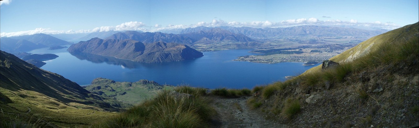
Roys Peak rises above Wānaka with wide views across Lake Wānaka and the Southern Alps. The commonly used route is a sustained uphill effort on an exposed slope rather than a short viewpoint stroll, and the open terrain offers little shelter from sun, wind or rapid weather changes. Treat the ascent and descent as one continuous workload, reserving at least half of the day’s energy for the long return. Set a primary route, a shorter alternative and a firm turnaround point before starting. Compare distance, ascent and surface with the group’s real experience, not only the headline viewpoint. Begin with enough daylight, take measured breaks and keep the return route easy to identify even if cloud reduces visibility. Mountain travellers should treat Roys Peak as an outing whose quality depends on preparation. Match distance and ascent to the least experienced person, keep turnaround time visible, and preserve energy for the return. A clear route plan creates more time to notice terrain, weather and scale without turning the day into a race. Check current track access and any seasonal restrictions before departure; do not rely on an old trip report for availability.
Deel je locatie eenmalig of voer een vertrekstad in. Je positie wordt afgerond en nooit gepubliceerd.
De hier getoonde prijzen zijn recent gecontroleerd of duidelijk aangeduid als indicatief.
Een gebalanceerd plan per dag, met realistische timing, eetstops en te boeken ervaringen.
The place itself
Notice Roys Peak and the details that make it recognizable.
Tijden zijn indicatief. Controleer de openingstijden en beschikbaarheid voordat je vertrekt.
Jaarlijks ritme
Klimaatritme
Maandelijkse maxima en minima hierboven; neerslag staat hieronder voor een snelle seizoensindicatie.Bron: Open-Meteo
Een compacte inpaklijst op basis van de omstandigheden ter plaatse.
Use Roys Peak as the destination context and choose verified regional food guides before deciding where or what to eat.
NZD ($)
English · Māori · New Zealand Sign Language
Pacific/Chatham
Type I
230V · 50Hz
Openbare deellinks tonen alleen details van openbare scans. Privéscans, vertrekpunt, budget, opgeslagen reisgegevens en accountinformatie worden hier niet weergegeven. Als de eigenaar deze scan verwijdert of privé maakt, werkt deze pagina niet meer.