

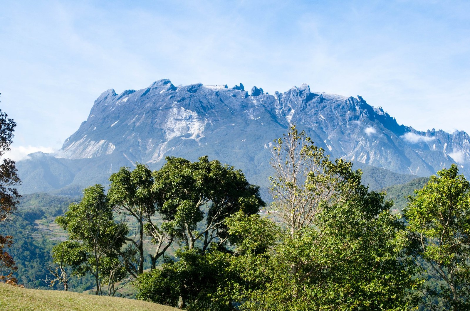
Mount Kinabalu
Ranau · Sabah · Malaysia
Mount Kinabalu gives mountain travellers a stronger day when route, weather and turnaround margins are decided first.
Mount Kinabalu gives mountain travellers a stronger day when route, weather and turnaround margins are decided first.
Plaats, kaart en geografische details geïdentificeerd in deze scan.
Sla de plaats op, voeg datums toe en vergelijk echte routes in Wayonara.
Mount Kinabalu rises above Sabah as a high granite massif with distinct vegetation zones from lower forest to exposed summit terrain. A summit itinerary is a managed high-altitude undertaking, not an independent casual hike, and the transition from humid lower slopes to cold upper ground is physically significant. Build the schedule around approved access, required guiding arrangements and gradual pacing; height gain matters more than fast distance. Set a primary route, a shorter alternative and a firm turnaround point before starting. Compare distance, ascent and surface with the group’s real experience, not only the headline viewpoint. Begin with enough daylight, take measured breaks and keep the return route easy to identify even if cloud reduces visibility. Mountain travellers should treat Mount Kinabalu as an outing whose quality depends on preparation. Match distance and ascent to the least experienced person, keep turnaround time visible, and preserve energy for the return. A clear route plan creates more time to notice terrain, weather and scale without turning the day into a race. Confirm current park permits, guide rules, accommodation and summit access before travel, and treat headache, nausea or unusual fatigue as signals to slow or descend.
Deel je locatie eenmalig of voer een vertrekstad in. Je positie wordt afgerond en nooit gepubliceerd.
De hier getoonde prijzen zijn recent gecontroleerd of duidelijk aangeduid als indicatief.
Alleen de scanlocatie is beschikbaar. Een volledige route vereist meer bevestigde stops.
Voorgesteld bezoek
Jaarlijks ritme
Klimaatritme
Maandelijkse maxima en minima hierboven; neerslag staat hieronder voor een snelle seizoensindicatie.Bron: Open-Meteo
Een compacte inpaklijst op basis van de omstandigheden ter plaatse.
Use Mount Kinabalu as the destination context and choose verified regional food guides before deciding where or what to eat.
MYR (RM)
English · Malay
Type G
230/240V · 50Hz
Openbare deellinks tonen alleen details van openbare scans. Privéscans, vertrekpunt, budget, opgeslagen reisgegevens en accountinformatie worden hier niet weergegeven. Als de eigenaar deze scan verwijdert of privé maakt, werkt deze pagina niet meer.